
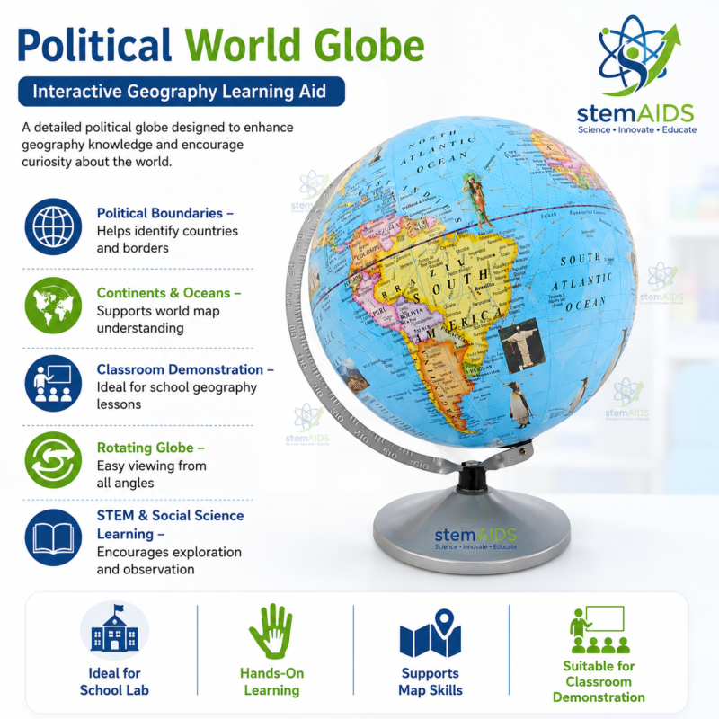
Quick Answer: The Political World Globe is a spherical model of Earth printed with countries, their borders, oceans and continents, usually in contrasting colours so each nation stands out. Unlike a flat wall map, a globe keeps shapes, areas and directions in true proportion, which makes it the reference for teaching location, distance and time zones.
Political Versus Physical: What This Globe Shows
A political world globe is coloured by country rather than by landform. Borders, national names and usually capital cities take priority, so students can locate a nation, name its neighbours and see how large it really is relative to others. A physical globe, by contrast, shades mountains, plains and ocean depths and is chosen when the lesson is about relief and landforms; schools that teach both often keep one of each, such as the Physical Shading Globe.
The spherical form matters because every flat map distorts something. On the familiar Mercator projection Greenland looks similar in size to Africa, yet on the globe Africa is roughly fourteen times larger. Placing the two side by side is one of the most effective ways to show students why map projections exist and what each one sacrifices.
Specifications
| Type | Political globe of Earth |
| Shows | Countries and borders, continents, oceans; lines of latitude and longitude |
| Main subjects | Geography, social studies, general science |
| Typical lessons | Location, distance, time zones, projections |
Care & Handling
- Lift the political world globe by its stand or base, never by the sphere or the meridian ring.
- Wipe the surface with a soft dry cloth; solvents and wet sponges can lift printing and varnish.
- Keep it out of strong sunlight so the country colours do not fade unevenly.
Applications
- Finding countries and capitals by latitude and longitude
- Comparing true country areas with their appearance on a Mercator wall map
- Tracing great-circle routes with a string to show why long flights curve towards the poles
- Showing the International Date Line and why neighbouring time zones differ by an hour
- Current-affairs and social studies lessons where students locate places in the news
Why Choose LabEquip
Geography and social studies teachers typically want one globe per classroom plus a few for group work. LabEquip includes this globe in its Astronomy Lab Kits range; tell the team how many rooms you are equipping through the contact page and ask about the current printing.
Related Products
- Physical Shading Globe: A physical shading globe that shows relief and landforms, complementing the country colours of the political globe.
- Map Of World Political: A flat political world map for comparing area and shape distortion with the globe.
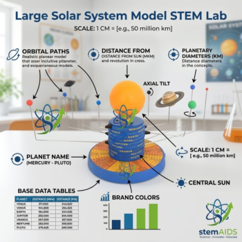
- Astronomical Globe Model: An astronomical globe that extends the equator and poles of Earth onto the sky.
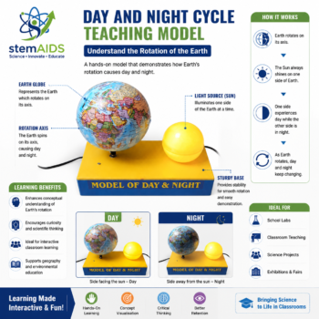
- Day and Night Cycle Teaching Model: A day and night model for teaching time zones alongside the globe’s lines of longitude.
Frequently Asked Questions
What is the difference between a political globe and a physical globe?
A political globe colours the world by country, showing borders, country names and usually capitals. A physical globe shades landforms such as mountains, plains and ocean depths. Choose the political globe for lessons on countries, location and boundaries, and a physical globe for relief and landforms.
Why does Greenland look so large on a wall map but not on a globe?
Flat maps using the Mercator projection stretch areas more and more towards the poles, so Greenland appears close to Africa in size. On a globe, which keeps true proportions, Africa is about fourteen times larger. Comparing the two shows students why map projections are a compromise.
How do students read latitude and longitude on a world globe?
Latitude lines run east to west and measure degrees north or south of the equator, from 0 to 90. Longitude lines run from pole to pole and measure degrees east or west of the prime meridian at Greenwich, from 0 to 180. A place is located by where its two lines cross.
How can a globe show the shortest route between two cities?
Stretch a piece of string tightly across the globe between the two cities; the string follows a great circle, the shortest route over a sphere. On a flat map the same route looks curved, which explains why long-distance flights often pass close to the poles.
Why is a world globe tilted on its stand?
The tilt shows Earth’s axis, which leans about 23.5 degrees from upright compared with its orbit. This tilt causes the seasons and changing day lengths, so mounting the globe at an angle helps students connect geography with the Sun-Earth relationship.
How do I know if the country borders on a political globe are current?
Borders and country names are printed at the time a globe’s map is produced, and they change only occasionally. Look at the newest countries and name changes in an atlas or reliable online source to compare. Small differences are a good lesson on how political maps are updated.
Last Updated: November 2026



Reviews
There are no reviews yet.